Working in Scottsdale means dealing with a surprisingly wide range of materials. On a single lot near the McDowell Sonoran Preserve, you can hit decomposed granite, windblown silt, and pockets of desert pavement all within the first ten feet. That mix demands more than a simple field classification. For our team, grain size analysis is the first real look at what the ground will do under load. We run ASTM D6913 for the coarse fraction retained on the No. 200 sieve, then switch to ASTM D7928 with a hydrometer for the fines. The combined curve tells us whether that brown layer is a well-graded sandy gravel (GW) or a silty sand (SM) prone to pumping during excavation. When a Scottsdale project needs a defensible soil profile, we complement the particle-size data with an Atterberg limits determination to lock down the USCS classification and confirm the plasticity characteristics that govern shrink-swell behavior in arid soils.
A well-graded Scottsdale alluvial deposit with Cu above 6 and Cc between 1 and 3 compacts to 95% modified Proctor with half the effort of a uniform fine sand.
How we work
Local ground factors
Scottsdale's soil profile often includes silty sands (SM) and low-plasticity silts (ML) that plot right near the A-line on a plasticity chart. A grain size curve that shows 15-25% fines with a flat slope in the silt range is a red flag for collapse potential under wetting. The 2018 monsoon season proved that: several residential foundations on the northwestern edge of the city settled unevenly after a single heavy storm, and post-failure testing showed the offending layer was a silty sand with just 18% passing the No. 200 sieve—material that looked clean in a hand auger but had enough silt to collapse when saturated. Without the hydrometer portion of the analysis, that 18% gets lumped into “passing No. 200” with no particle-size detail below 75 µm. The full sedimentation curve separates silt-sized from clay-sized particles and lets us flag soils susceptible to piping, frost heave (rare here but relevant for high-elevation projects), or collapse. For sites within the City of Scottsdale's jurisdiction, the geotechnical report must include grain size curves with hydrometer data whenever more than 12% passes the No. 200 sieve per the local amendment to IBC Chapter 18.
Reference standards
ASTM D6913/D6913M-17: Standard Test Methods for Particle-Size Distribution (Gradation) of Soils Using Sieve Analysis, ASTM D7928-21e1: Standard Test Method for Particle-Size Distribution (Gradation) of Fine-Grained Soils Using the Sedimentation (Hydrometer) Analysis, ASTM D2487-17e1: Standard Practice for Classification of Soils for Engineering Purposes (Unified Soil Classification System), ASTM C702/C702M-18: Standard Practice for Reducing Samples of Aggregate to Testing Size, IBC 2021 Chapter 18 (Soils and Foundations) with City of Scottsdale local amendments
Complementary services
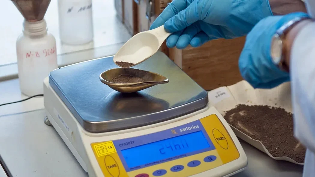
Sieve Analysis (Coarse Fraction)
Mechanical sieving per ASTM D6913 for material retained on the No. 200 sieve. We report percent passing each sieve, the gradation curve, and Cu/Cc coefficients. Typical turnaround is 2 working days for a standard 5 kg sample.
Hydrometer Analysis (Fine Fraction)
Sedimentation testing per ASTM D7928 using a 152H hydrometer. We correct for temperature, meniscus, and dispersant concentration. Delivers the silt-clay split and clay-size percentage below 2 µm.
Combined Grain Size + Atterberg Package
Full sieve plus hydrometer curve with liquid limit, plastic limit, and plasticity index per ASTM D4318. We provide the complete USCS classification with group symbol and group name on one summary sheet.
Typical parameters
Common questions
What is the cost of a grain size analysis including sieve and hydrometer for a Scottsdale project?
For a combined sieve plus hydrometer test on one sample, our fee ranges from US$110 to US$210 depending on whether the material is predominantly sand or contains a significant clay fraction that requires extended sedimentation time. A package with Atterberg limits falls near the upper end of that range.
How long does a hydrometer analysis take from start to finish?
The full sedimentation sequence runs 24 hours minimum per ASTM D7928, with readings at specified intervals from 1 minute to 1440 minutes. Sample preparation, sieving the coarse fraction, and data reduction add another working day. A complete combined sieve-plus-hydrometer report is typically ready in 3 to 4 working days.
Why does Scottsdale clay sometimes plot below the A-line on the plasticity chart?
Many Scottsdale soils contain micaceous or rock-flour fines derived from weathered granite and schist of the surrounding ranges. These particles are physically clay-sized (below 2 µm) but have low plasticity because they lack the sheet-silicate structure of true clay minerals. The hydrometer curve will show a significant clay-size fraction, but the Atterberg limits reveal low plasticity, and the material classifies as ML (silt) rather than CL (lean clay). This disconnect is common in the foothills and is one reason we always recommend running Atterberg limits alongside the grain size analysis on fine-grained Scottsdale samples.
What is the minimum sample mass required for a reliable grain size test?
Per ASTM D6913, the minimum dry mass depends on the nominal maximum particle size. For a soil with a maximum particle size of 3/4 inch, we need at least 500 g. If gravel up to 3 inches is present, the required mass jumps to 20 kg or more. For the hydrometer portion, we need approximately 200 g of minus-No. 200 material, which often requires processing a larger bulk sample if fines content is low—a common scenario in Scottsdale's sandy alluvium.
Can you run a grain size analysis without the hydrometer if I only need the sand and gravel percentages?
Yes, a wash-sieve analysis per ASTM D6913 gives you the gravel-sand-fines split and the gradation of the coarse fraction without the sedimentation step. It is quicker and cheaper. However, if more than 12% of your sample passes the No. 200 sieve, the City of Scottsdale's geotechnical review typically requires the full hydrometer curve to characterize the fines for foundation design or drainage assessment.