Scottsdale's transformation from a small farming community into a sprawling urban center has pushed development onto increasingly complex desert terrain. The old citrus groves near Indian Bend Wash were underlain by predictable alluvial silts, but today's projects stretch into the foothills of the McDowell Mountains, where granitic bedrock lies just inches beneath the surface or is covered by poorly sorted colluvium. At our geotechnical laboratory, we have watched the city grow northward into areas where soil conditions can shift dramatically within a single parcel. An exploratory test pit provides the most direct way to observe these transitions because there is simply no substitute for the human eye when identifying caliche seams, cobble lenses, and prehistoric channel deposits. When you are dealing with sites that sit on the boundary between the Basin and Range's deep sediments and the uplifted metamorphic rocks of the Mazatzal Province, you need more than just a drill log—you need to see the stratigraphy exposed across a vertical face. Our team performs test pit excavations following ASTM D2487 for field classification, ensuring that what we log matches what your structural engineer will actually encounter during excavation.
Seeing the soil face firsthand tells you more about how it will perform under load than any indirect test ever could.
How we work
Local ground factors
A developer we worked with near the Central Arizona Project canal assumed uniform sandy gravel across his parcel based on a single boring, but our test pit revealed a buried clay-filled channel running diagonally through the building footprint. Had that gone unnoticed, differential settlement would have cracked the slab within the first monsoon season. Scottsdale's desert soils are notorious for collapse potential when wetted, particularly in older alluvial fans where silt particles are held together by soluble salts that dissolve with landscape irrigation. We have seen post-construction distress in neighborhoods like Gainey Ranch where imported fill was placed over natural desert pavement without proper compaction control. An exploratory test pit lets us measure in-situ density at depth using sand cone or nuclear gauge methods, identify loose zones, and recommend the appropriate remediation—whether that means over-excavation, moisture conditioning, or deep dynamic compaction. The IBC and local Scottsdale amendments require adequate subsurface investigation before permit approval, and skipping a direct observation method like a test pit can lead to expensive change orders when the excavator hits something unexpected.
Reference standards
ASTM D2487 – Standard Practice for Classification of Soils for Engineering Purposes (Unified Soil Classification System), OSHA 29 CFR 1926 Subpart P – Excavations, IBC (International Building Code) – Chapter 18 Soils and Foundations, ASCE 7 – Minimum Design Loads and Associated Criteria for Buildings and Other Structures
Complementary services
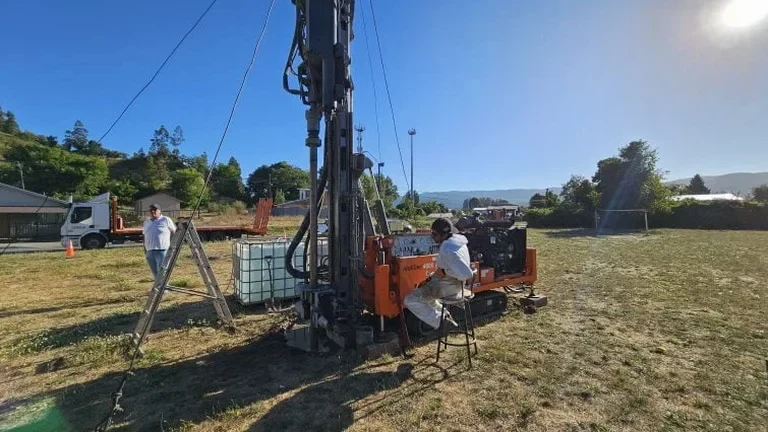
Standard exploratory test pit
Excavation to depths of 8–14 feet with full stratigraphic logging, photography, and bulk sampling for laboratory index testing. Ideal for foundation design and site characterization on residential and light commercial lots.
In-situ density and compaction testing
Field density measurement using sand cone (ASTM D1556) or nuclear gauge methods directly on pit walls or floor. We verify compaction of existing fill and natural soils to support slab-on-grade and pavement design.
Caliche and hardpan assessment
Specialized investigation of cemented layers common in Scottsdale's desert soils. We evaluate thickness, continuity, and rippability to help contractors plan excavation and determine if rock removal provisions apply.
Collapse potential evaluation
Testing program combining in-situ density, moisture content, and laboratory consolidation tests on undisturbed samples to quantify the risk of hydro-collapse when native soils are wetted by irrigation or stormwater.
Typical parameters
Common questions
What does an exploratory test pit cost for a typical Scottsdale residential lot?
For a standard investigation on a single-family residential site in Scottsdale, exploratory test pit services generally fall within the range of US$550 to US$750 per pit, which includes excavation, logging, sampling, and backfill. The final figure depends on access constraints, depth requirements, and whether we are conducting in-situ density testing on site. Larger commercial projects requiring multiple pits or shoring for deeper excavations will be quoted individually after we review your site plan.
How long does the test pit remain open, and what happens to the excavation afterward?
Most test pits are open for one working day to allow for logging, photography, and sampling, then backfilled the same afternoon. We backfill in lifts with compaction using the excavated material or engineered fill if the native soil is unsuitable, and we restore the surface to its pre-existing condition. The pit is never left unattended while open, and our field crew follows OSHA excavation safety protocols throughout the process.
Can a test pit replace a boring for my foundation design?
A test pit and a boring serve complementary purposes. The pit gives you a continuous visual profile and lets us extract high-quality undisturbed samples, but it is limited by depth—typically 14 feet before shoring becomes mandatory under OSHA regulations. For deeper exploration, we recommend pairing test pits with an SPT drilling program so you have shallow visual data and deep penetration resistance values, giving your geotechnical engineer the complete dataset needed for a solid foundation recommendation.
Do I need a permit to excavate a test pit on my Scottsdale property?
Test pits excavated solely for geotechnical investigation and backfilled the same day generally do not require a separate grading permit in Scottsdale, but you must still comply with Arizona 811 utility locating requirements. We call in a ticket at least two full business days before mobilization and clear all underground utilities before the excavator breaks ground. If your site is within a floodplain or contains protected native vegetation, additional coordination may be needed. More info.